Lodging
Lodging Chart
Marathon
Study Butte
Terlingua
Lajitas
Outlying Areas
Big Bend National Park
Parks
National Park
State Park
3 Dreamy Days in Big Bend, Texas
Hiking Trails for Young Children in Big Bend National Park
National Park Info
Boquillas Canyon
More...
Directions
Drive
Fly
Train
Motorcycles
Vehicle Rental
Activities
Bicycles
River Trips
Birding
Culture
Golf
Hiking
Night Life
Shooting
More...
Food And Drink
Marathon
Study Butte
Terlingua
Lajitas
Big Bend National Park
Outlying Area
Communities
Terlingua
Lajitas
Marathon
Study Butte
Big Bend National Park
Alpine
BIG BEND NATIONAL PARK WEATHER

Big Bend

Colorado Canyon
Colorado Canyon, in Big Bend Ranch State Park, is the most accessible of the area’s major river canyons, and offers vehicle accessible views of the river as well as a choice of short float trips.

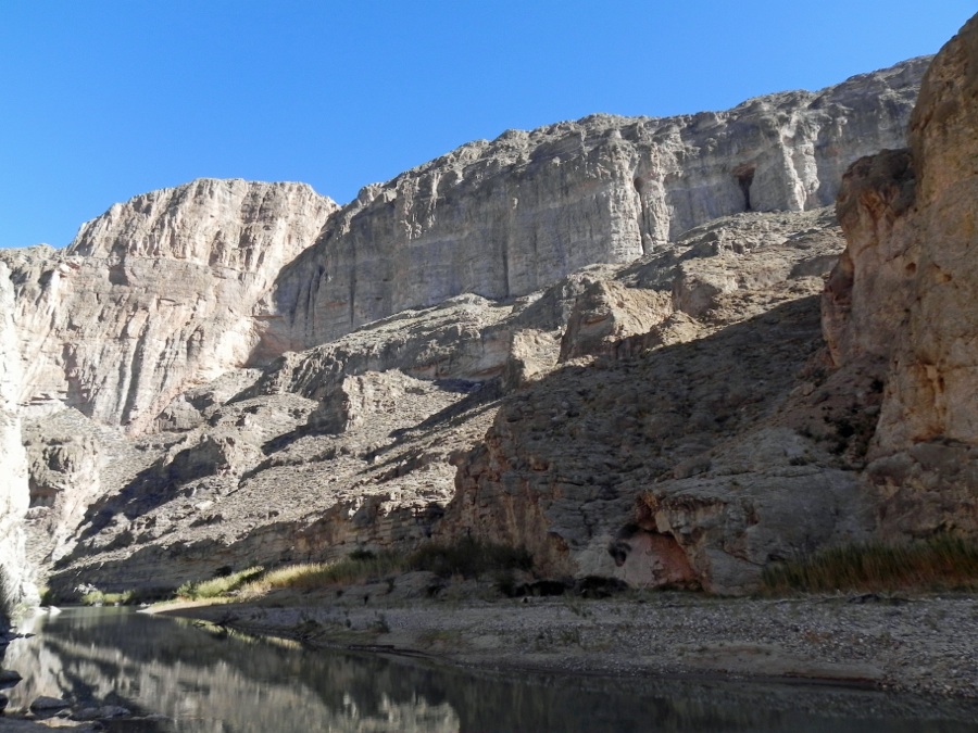
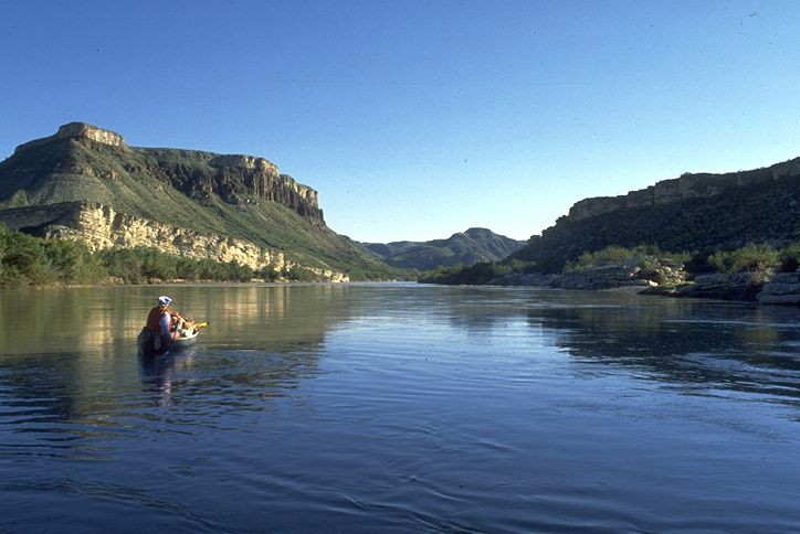
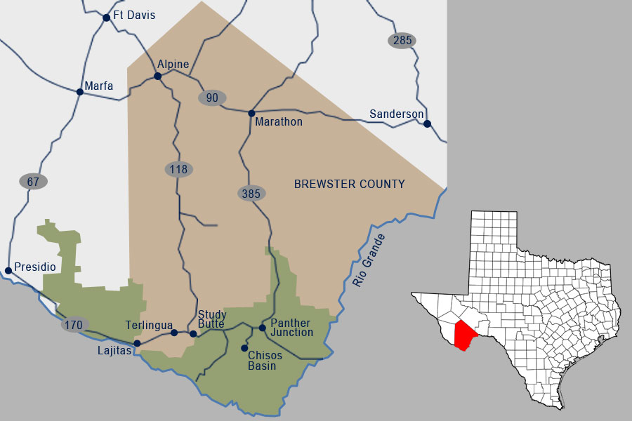
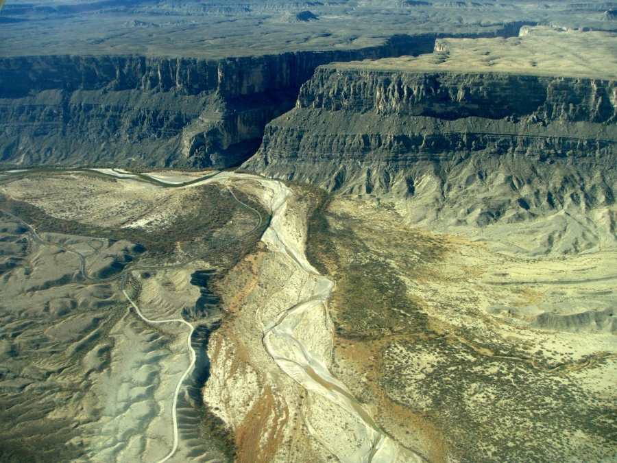
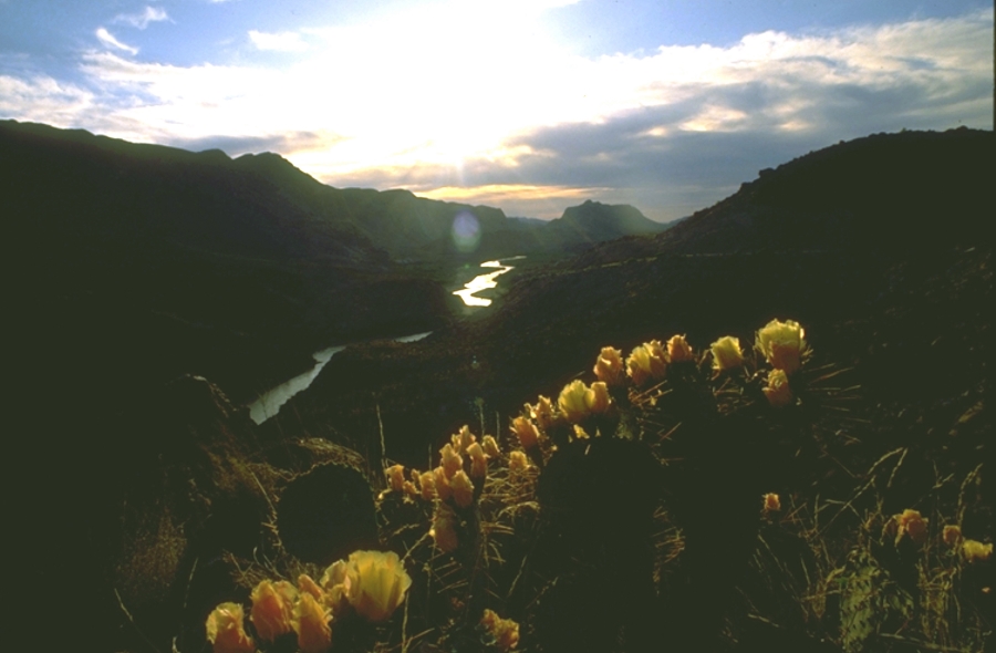
Most Rio Grande canyons have been carved out of dense limestones, which tend to erode into sheer, almost vertical walls. Colorado, however, is a canyon of a different color. Unlike all the other river canyons in Big Bend, Colorado is carved from volcanic material. The walls of this rugged gorge are layers of ancient ash flows and falls. Incandescent clouds of atomized magma were spewed from vents in the nearby Sierra Rica and Bofecillos Mountains, then solidified over a wide area. Over thousands of years the Rio Grande carved its way down to its present level and a wide variety of desert and riparian plants took hold in the mineral rich soil, making Colorado Canyon a hanging garden of yuccas, cacti, and other life.

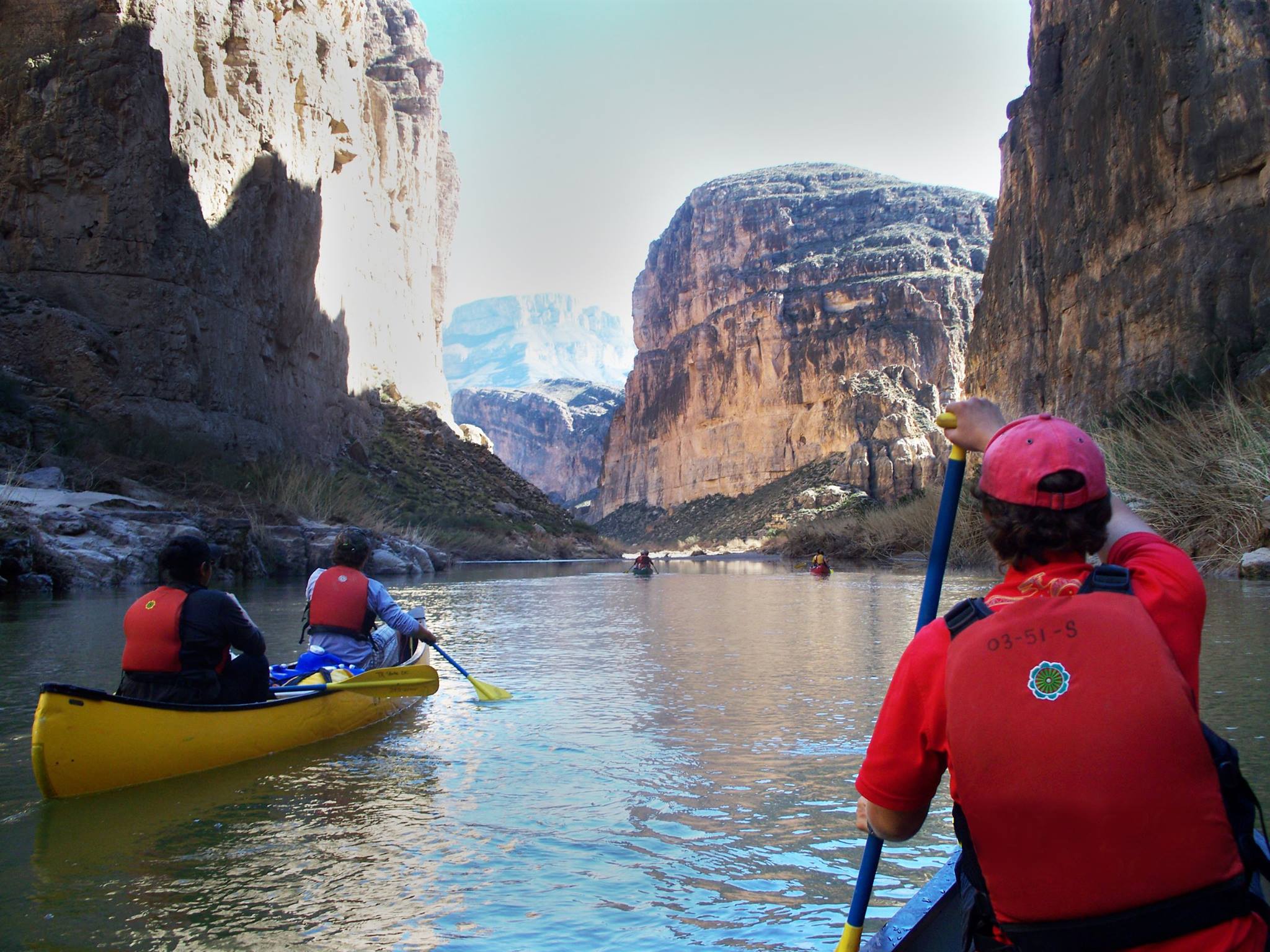
Colorado Canyon has the highest average gradient of any stretch of Rio Grande in Big Bend. This means more rapids. Guacamole, Quarter mile and Panther often rate Class ll-lll, and several other minor rapids pick up the pace. Put in is at Big Bend State Park’s Rancherias River access point approximately 15 miles west of Lajitas on FM 170, and at the earliest take out is at Madera River Access, 11 miles downstream. At most water levels, Colorado Canyon makes for a reasonable one-day trip. At low levels, it is a long day in a raft, and especially if the normal stiff afternoon headwind is present.

This eleven-mile section of river from Madera to Lajitas is not contained within a steep gorge, but the luxuriant floodplain and the rugged vistas provide for a variety of enjoyable short trips. A 3-mile trip from Madera Access to Grassy Banks is leisurely even at the lowest water levels. This section is popular for those who just want a relaxing morning or afternoon on the river, with no rushing allowed. An igneous outcropping in midstream forms a series of smoothly eroded ledges that make a fun rapid at normal water levels, and an impressive roller coaster when the river’s up. This section is one of the best for bird watching, and guides continually spot interesting and uncommon species. It is a good idea to check with local outfitters about current conditions before going on the Rio Grande.


Recent Posts
3 Dreamy Days in Big Bend, Texas

3 Dreamy Days in Big Bend, Texas

Candelilla House Big Bend Holiday Hotel Craggy canyons tower over the mighty Rio Grande in west Texas, separating the United States from Mexico. The Big Bend area of Texas offers a blissful coexistence of mountain terrain and desert plains. Entire mesas covered with...

Hiking Trails for Young Children in Big Bend National Park


Hiking Trails for Young Children in Big Bend National Park


By Belle Peña-Lancaster Planning a trip to the Big Bend Region with children in tote can be a bit intimidating. The road wear you incur while traveling just to get to the Brewster County line is unavoidable, however it’s completely worth it. From one family to another...

National Park Info

National Park Info

Big Bend National Park encompasses the largest protected area of the Chihuahuan Desert in the United States. The Rio Grande Wild and Scenic River forms its southern boundary, and it's the only park in the United States that contains a complete mountain range - the...

Boquillas Canyon

Boquillas Canyon

Boquillas Canyon is the longest and deepest canyon in Big Bend National Park. The vertical relief from nearby Pico del Carmen, to river level is over 7,000 feet, somewhat deeper than the Grand Canyon of the Colorado. From the Parking Lot at the endo of the Boqullas...

Rio Grande Canyons

Rio Grande Canyons

The Rio Grande is a continental river which forms the border between Mexico and the US and gives the Big Bend and the state of Texas their distinct shapes. The Rio Grande begins in the high snowfields of the continental divide, in the San Juan range of central...

Chisos Mountains

Chisos Mountains

The Chisos Mountains are the heart of Big Bend National Park. They extend twenty miles from Punta de la Sierra in the southwest to Panther Junction in the northeast. It is the only mountain range totally contained within a single national park. Among the highest peaks...