Routes, Drive Times & Road Tips to Big BendBig Bend sits deep in far West Texas. Whether you’re coming from El Paso, Midland/Odessa, San Antonio, Austin, Houston, or Dallas/Fort Worth, choose the route that matches your arrival town and the part of the park you want...


Austin to Big Bend: Best Routes, Drive Times & Road Tips
From the live-oak hills of the Hill Country to the desert mountains of West Texas, the drive from Austin to Big Bend is a classic Texas road trip. Plan for roughly 8–9 hours of wheel time (plus stops) and 475–500 miles, depending on your route and first destination in the park.
Primary Route: US-290 → I-10 West → Fort Stockton
This is the fastest, most straightforward path—great if your goal is to reach the park with minimal detours.
- Austin → I-10 West: Take US-290 west through the Hill Country to join I-10 near Junction.
- I-10 → Fort Stockton: Cruise west on I-10 to Fort Stockton (major fuel/food stop).
- Choose your gateway:
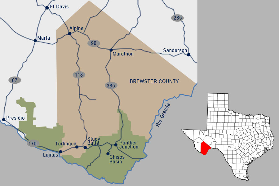
- Eastern Entrance (Persimmon Gap): From Fort Stockton, take US-385 south to Marathon, continue on US-385 to the park’s east entrance and on to Panther Junction.
- Western Entrance (Maverick): From I-10, continue a few more miles to US-67, head south to Alpine, then TX-118 south to Study Butte/Terlingua and the west entrance. Ideal for Ross Maxwell Scenic Drive and the River Road (FM 170).
Alternate Route: I-35/I-10 → US-90 via San Antonio & Del Rio
A scenic option with small towns, borderlands views, and fewer interstate miles.
- From Austin, go south toward San Antonio and pick up US-90 west through Uvalde and Del Rio.
- Continue on US-90 to Marathon (gateway to the US-385 east entrance) or on to Alpine (connect to TX-118 for the west entrance).
- This route is often shorter in distance but slower in time due to town speeds and stoplights. For more detail from that hub, see Drive from San Antonio.
Estimated Drive Times & Distances
- Austin → Panther Junction (via I-10/US-385): ≈ 475–500 miles, about 8–9 hours
- Austin → Terlingua/Study Butte (via Alpine/TX-118): ≈ 500–520 miles, about 8.5–9.5 hours
- Austin → Marathon (US-90 or I-10/US-385): ≈ 410–430 miles, about 6.5–7.5 hours
Actual times vary with traffic, weather, construction, and stops.
Great Stops Along the Way
- Fredericksburg (US-290): Hill Country charm and quick bites before merging onto I-10.
- Junction (I-10): Llano River vistas and an easy refuel point.
- Del Rio (US-90): Borderlands landscapes and supplies before the long westward stretch.
- Marathon & Alpine: Classic West Texas towns for fuel, food, and last-minute gear.
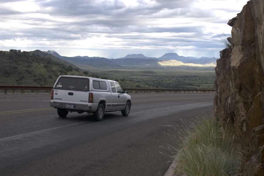
Road Tips, Fuel & Safety
- Top off often: Services thin out west of Fort Stockton; plan fuel stops in Marathon, Alpine, and Study Butte/Terlingua.
- Inside the park: Speed limit is generally 45 mph (lower where posted). Distances are long—budget time.
- Navigation: Cell coverage is spotty. Download offline maps and keep a paper map as backup.
- Heat & hydration: Carry at least one gallon of water per person per day, even in cooler months.
- Wildlife: Watch for deer, javelina, and livestock—especially at dawn and dusk.
Need a Car?
Flying in or meeting friends en route?
See Vehicle Rentals to Big Bend for options from El Paso, Midland, and Alpine.
More Route Guides
Explore other starting points:

Author: Edison
visitbigbend

Chisos Basin to remain open in Big Bend National Park. 🙌
With construction plans on hold, the previously anticipated closures will no longer take place, which means that winding road into the mountains will stay open and ready to welcome visitors.
Those who know, know: when summer heat settles over the desert, the Chisos Basin answers with fresh breezes, cooler temps and shaded trails.
Visit nps.gov for more information.

We love Big Bend Country for its wide-open beauty, rich culture, outdoor access, and the communities that call this region home.
Visit Big Bend aligns with the Brewster County Commissioners Court resolution expressing concern over a proposed physical border wall in the Big Bend region and supporting solutions that protect the land, the visitor experience, and the long-term well-being of this place. Full resolution at the link in bio.
We love this land. 💜✌️
Photo by @marcusc_photo
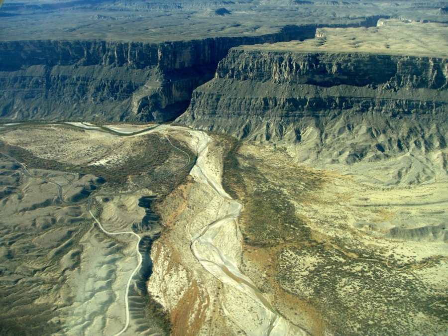
A little current, big canyon walls, and a shoreline snack break whenever you feel like it, that’s a Rio Grande adventure in Big Bend National Park. If your week has been loud, consider this your reminder to trade the to-do list for a paddle. Wear your PFD, bring plenty of water, and don’t forget sunscreen. We’ll provide the slower pace! Wonderful shot by @marcusc_photo
#visitbigbend #bigbendnps #bigbendnationalpark
More Big Bend National Park through the eyes of @goodmorningamerica!
Full piece linked in bio.
@bigbendnps
#bigbendnationalpark #visitbigbend
Really exciting news: Michael Strahan’s Big Bend adventure aired on Good Morning America this morning, and it’s a love letter to two of our favorite things: pitch-black night skies and a canoe trip through Santa Elena Canyon.
Check out the first @goodmorningamerica piece about our stunning dark skies here where photographer @tonymaples gives @michaelstrahan a front row seat to the Milky Way. Full piece linked in bio!
#BigBend #BigBendNPS #BigBendNationalPark #HikeTexas #TravelTexas #WestTexas #Marfa #MarathonTX #TerlinguaTX #TexasTravel #DarkSkies #Terlingua #VisitBigBend #VBB #BigBendNP @nationalparkservice
Out here, even the horses know how to take their time.
Photo by @marcusc_photo
Out here, the places that last usually aren’t trying to impress anyone. Chili Pepper Cafe is humble, local, and exactly what it claims to be, made-in-house Mexican food done right. Huevos a la Mexicana, beans that deserve their own fan club, and service with some real personality.
If you’re rolling through and ready to eat, start here.
@backpackermag put Lost Mine Trail on “Hike of the Week.” We won’t argue with that.
This is one of those Big Bend walks that starts out polite and ends with you standing very still, looking a long way into the Chisos, remembering you are small and lucky.
If you go, start early, parking is limited, carry more water than you think you need, and leave it better than you found it. Then come back and tell us what the view had to say.
Link to Backpacker article in bio.
#BigBend #BigBendNPS #BigBendNationalPark #HikeTexas #TravelTexas #WestTexas #Marfa #MarathonTX #TerlinguaTX #TexasTravel #LostMineTrail #ChisosMountains #LeaveNoTrace #HikingTexas #VisitBigBend #VBB
Recent Posts
Drive to Big Bend
Routes, Drive Times & Road Tips to Big BendBig Bend sits deep in far West Texas. Whether you’re coming from El Paso, Midland/Odessa, San Antonio, Austin, Houston, or Dallas/Fort Worth, choose the route that matches your arrival town and the part of the park you want...
Drive from Houston
Houston to Big Bend: Best Routes, Drive Times & Road TipsThe trip from Houston to Big Bend is a true cross-Texas adventure—piney woods to Hill Country to wide-open desert. Expect roughly 8–9 hours of drive time and about 540–600 miles, depending on your route and...
Fly to Big Bend
Commercial & Private Air Travel Options for Big BendPicture yourself sweeping over endless West Texas plains, the sun glinting off distant mesas as you descend into the rugged embrace of Big Bend’s wild frontier. By flying into El Paso, Midland, or even chartering...
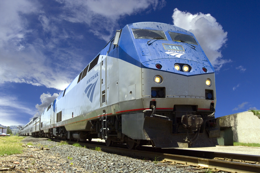
Travel to Big Bend by Train
Experience the Historic Sunset Limited Rail RouteBoard Amtrak’s Sunset Limited—the oldest continuously operating named train in the U.S.—for a scenic journey between New Orleans and Los Angeles. This route stops in Alpine, TX three times weekly, offering a relaxed way...
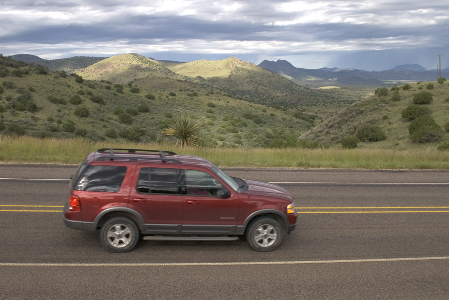
Vehicle Rentals to Big Bend
Convenient Vehicle Rental Options to Big Bend from El Paso, Midland, Alpine & MoreFlying in? Renting a vehicle at a major airport is the fastest, most reliable way to reach Big Bend National Park—and gives you the freedom to explore every scenic mile on your own...
Drive from San Antonio
San Antonio to Big Bend: Scenic Road Trip Highlights & Hidden Stops Along the WayAt roughly 430 miles, the journey from San Antonio to Big Bend National Park takes you from the Hill Country’s rolling hills into West Texas’s rugged desert. Plan for about 7–8 hours of...