Lodging
Lodging Chart
Marathon
Study Butte
Terlingua
Lajitas
Outlying Areas
Big Bend National Park
Parks
National Park
State Park
3 Dreamy Days in Big Bend, Texas
Hiking Trails for Young Children in Big Bend National Park
National Park Info
Boquillas Canyon
More...
Directions
Drive
Fly
Train
Motorcycles
Vehicle Rental
Activities
Bicycles
River Trips
Birding
Culture
Golf
Hiking
Night Life
Shooting
More...
Food And Drink
Marathon
Study Butte
Terlingua
Lajitas
Big Bend National Park
Outlying Area
Communities
Terlingua
Lajitas
Marathon
Study Butte
Big Bend National Park
Alpine
BIG BEND NATIONAL PARK WEATHER

Big Bend

Mariscal
Mariscal is the most remote of the Park River Canyons, and the only way to see it is by river. Getting to the put-in point at Talley requires over 30 miles of driving on rough dirt road. It is important to check road and weather conditions before entering this remote desert backcountry. Difficult as it may be to get there, the trip is worth well worth the effort.

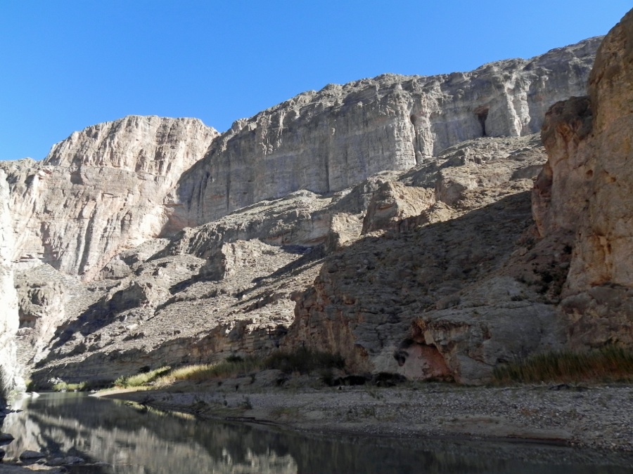
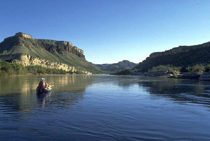
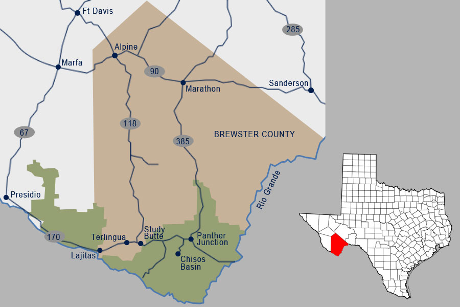
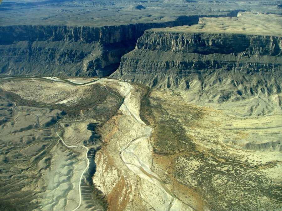
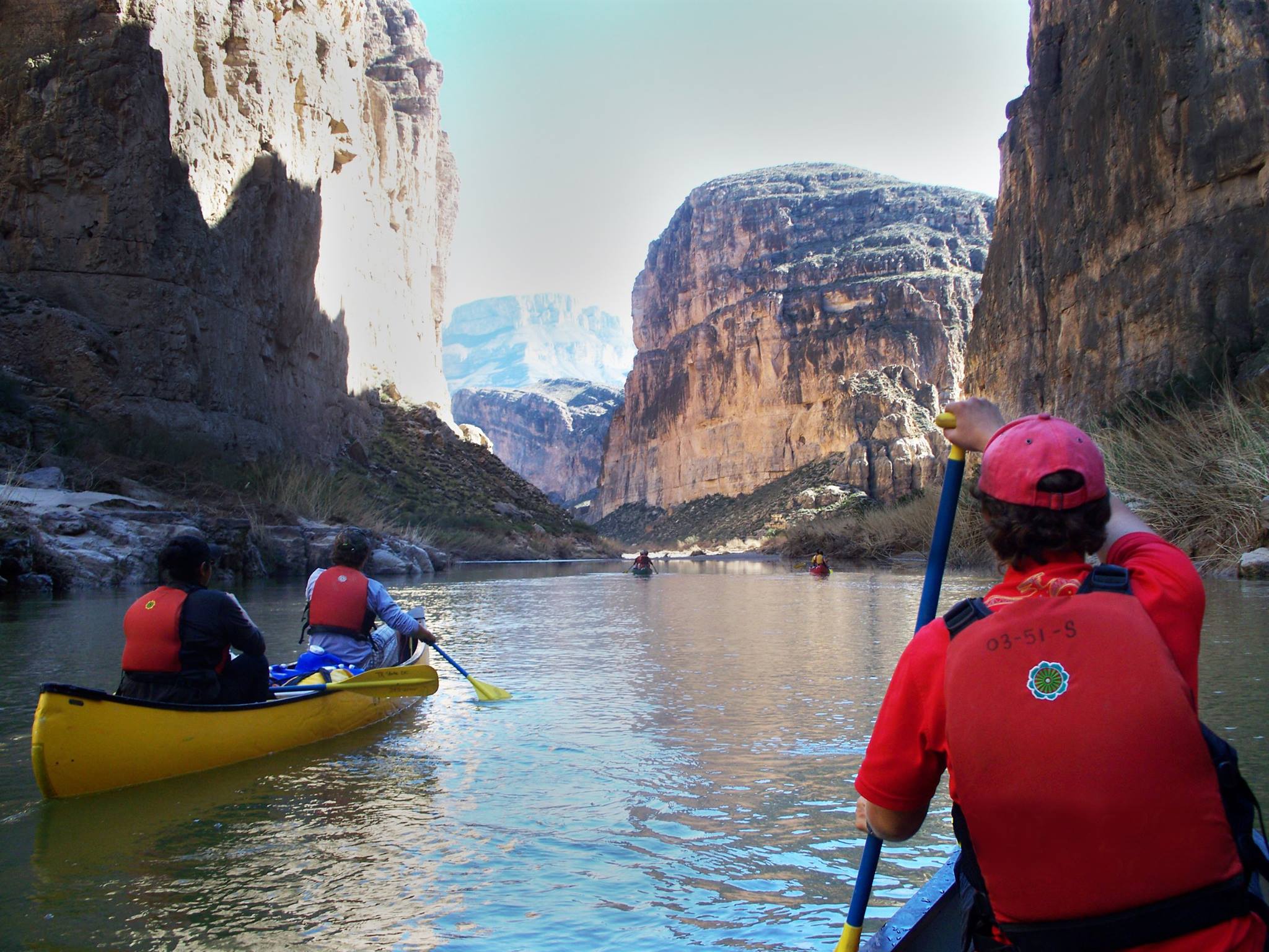
Mariscal is the narrowest and deepest of the Rio Grande Canyons. The total trip length is 11 miles from Tally to Solis, and 7 miles of that distance is pure canyon. Some walls rise over 1600 feet in a single vertical leap. There are two rapids of notice within the canyon, the “Rockpile” and the “Tight Squeeze”.  Both rapids require careful navigation at high or low water levels. The Tight Squeeze is easily scouted from above, and from the scouting point, there it is a short scramble up to the “Hermit’s Cave”, which is on a ledge overlooking the river just beyond the rapid.

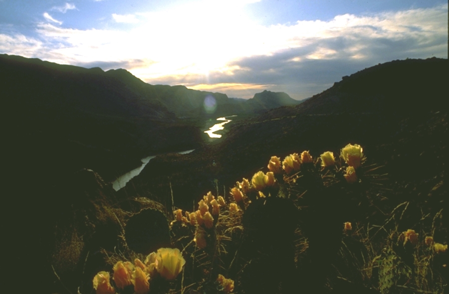
Halfway through the trip is “The Break” or “Cross Canyons” which interrupts the vertical nature of the canyon for a few hundred yards.  Most groups taking overnight trips choose to camp here. Another excellent camping spot is just outside the canyons, a little over two miles from the take out at Solis. For those seeking a longer wilderness experience, it is possible to go another 23 miles to Rio Grande Village, and pass through both San Vicente and Hot Springs Canyons.It is always a good idea to check with local outfitters for current condition and help with trip logistics.

Recent Posts
3 Dreamy Days in Big Bend, Texas

3 Dreamy Days in Big Bend, Texas

Candelilla House Big Bend Holiday Hotel Craggy canyons tower over the mighty Rio Grande in west Texas, separating the United States from Mexico. The Big Bend area of Texas offers a blissful coexistence of mountain terrain and desert plains. Entire mesas covered with...

Hiking Trails for Young Children in Big Bend National Park


Hiking Trails for Young Children in Big Bend National Park


By Belle Peña-Lancaster Planning a trip to the Big Bend Region with children in tote can be a bit intimidating. The road wear you incur while traveling just to get to the Brewster County line is unavoidable, however it’s completely worth it. From one family to another...

National Park Info

National Park Info

Big Bend National Park encompasses the largest protected area of the Chihuahuan Desert in the United States. The Rio Grande Wild and Scenic River forms its southern boundary, and it's the only park in the United States that contains a complete mountain range - the...

Boquillas Canyon

Boquillas Canyon

Boquillas Canyon is the longest and deepest canyon in Big Bend National Park. The vertical relief from nearby Pico del Carmen, to river level is over 7,000 feet, somewhat deeper than the Grand Canyon of the Colorado. From the Parking Lot at the endo of the Boqullas...

Rio Grande Canyons

Rio Grande Canyons

The Rio Grande is a continental river which forms the border between Mexico and the US and gives the Big Bend and the state of Texas their distinct shapes. The Rio Grande begins in the high snowfields of the continental divide, in the San Juan range of central...

Colorado Canyon

Colorado Canyon

Colorado Canyon, in Big Bend Ranch State Park, is the most accessible of the area's major river canyons, and offers vehicle accessible views of the river as well as a choice of short float trips. Most Rio Grande canyons have been carved out of dense limestones, which...